WASHINGTON - It’s hard to hit targets you can’t see.
That’s the problem Willie Nelson is trying to solve as director of the Army’s Assured Positioning, Navigation and Timing (APNT) Cross-Functional Team. In that role, Nelson is integrating the Army’s efforts to locate beyond-line-of-sight threats and delivering accurate targeting data to weapons systems in a timely manner. In order to do that, his team is leveraging space-based sensors, artificial intelligence and a new scalable ground system that can connect to all of the Army’s weapon systems.
Of course, the first part of the problem is finding the threats.
For Nelson, the clear answer is satellites. While aerial platforms can provide that sensing capability, that’s only realistic in a scenario with air superiority. That’s not always the case.
“In essence, the deeper and deeper you go, you can’t assume air superiority … so really, quite frankly, the only avenue we have is to sense from space,” said Nelson.
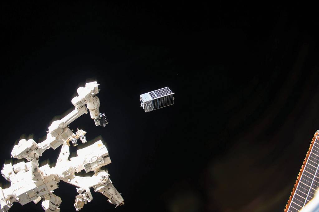
The growing exploitation of low Earth orbit for imagery and sensing has opened new doors for the Army, said Nelson. It’s now possible to put deep sensing sensors on orbit that can collect that data without even alerting the adversary.
“Quite frankly, that is a gamechanger,” said Nelson.
While the primary tool is electro-optical imagery - the traditional satellite images soldiers are used to - Nelson said the Army is interested in using other phenomenologies, including synthetic aperture radar and radio frequency sensing. Ultimately, those sensing capabilities need to be persistent and directly integrated in theater all the way down to the guns, he added.
With those sensors on orbit, the next step is to get the data to the ground. Traditionally, that process can take hours or even days, as the satellites have to wait until they pass over an appropriate ground station to downlink. That timeline was never going to work for the Army.
Speed is critical and service wants to be able to stop “shoot and scoot” attacks, Nelson referring to enemies who move to an area, set themselves up quickly, launch an attack and move on. Waiting hours for sensor information just wasn’t going to cut it. By the time targeting data was available, the threat could have attacked and moved on to a new location.
Waiting for data to be downlinked in the continental United States and then transported back to the theater was never a realistic option, explained Nelson. That’s where the Army’s TITAN solution fits in. TITAN is a new scalable, transportable ground system in development that will be able to downlink data from those satellites in theater, and in turn task them to collect more imagery.
“One that data comes down, there’s a variety of tools that we’re pursuing,” said Nelson. “One of those is referred to as Prometheus.”
Prometheus is a machine learning algorithm that takes in the various data delivered by on orbit satellites —be it electro-optical, synthetic aperture radar or something else — and fuse it into meaningful, usable targeting data.
And once Prometheus creates that targeting data, it transfers it to a new program referred to as SHOT. SHOT is aware of all of the blue fires capabilities, explained Nelson. SHOT can take targeting data on multiple threats, compare it against available weapons systems, and determine which fire capability is the best for each threat.
All of that information is then seamlessly delivered to a firing system such as the Advanced Field Artillery Tactical Data System, which responds to the threat. Nelson emphasized that there are humans in the loop in this system.
But none of these steps are easy. The APNT team is an integrator of related efforts across the Army, pulling in various advanced technologies to provide better sensing capabilities, better target identification, and to speed up that sensor to shooter timeline.
Nelson declined to share exactly how fast that timeline could operate at present.
“We’re shaving off what used to be days, which used to be morning and afternoon types of data, from hours down to minutes,” said Nelson.
In March, Nelson’s team was able to conduct a live-fire exercise in Germany to see how this sensor to shooter chain works in reality.
That demonstration was able to use a variety of government and commercial satellites, utilizing electro-optical and synthetic aperture radar imagery, as well as emitter detection capabilities, said Nelson. Those on orbit sensors were able to collect data about targets and then downlink to a TITAN surrogate ground station, where it was then disseminated to the appropriate weapon systems. Thanks in part to that TITAN technology and the availability of those on orbit sensors, the entire exercise was able to take place in theater.
“We’re doing that entire fires kill chain all within theater, and I think that’s critical. We’re able to receive that data in theater, and process that data, be able to develop targeting coordinates from that, put it directly into the firing system AFATDS, and be able to launch weapons on that target. And we’re doing that now very successfully in a very short time,” said Nelson.
“Beyond just the organics of the test—bringing the data down, running it through its algorithms, getting it into the guns and the excitement of live fires—we deployed a team of data managers across that architecture, which frankly goes across Germany, and had them at each of the nodes along the way which that data transcends the operational architecture,” he added.
Those data managers were able to record how quickly data was transferred from one node to the next, giving the Army critical data on how the current system actually works. The Army can now input that data into their models for more accurate war gaming and simulations.
“While this was a technical demonstration, at its core it really was more about how do we operationalize this capability and how do we quickly get this into the field as a capability that soldiers can use,” said Nelson.
Nathan Strout covers space, unmanned and intelligence systems for C4ISRNET.


